An overflight fee is, in practice, a route air navigation service charge: a payment aircraft operators make to recover the cost of air traffic services used along a route. Under the principles ICAO sets out, a state should not charge simply for the right to cross its airspace, but it may recover properly allocable costs for the services it provides. That distinction explains how these charges are calculated, why a country can bill for airspace it does not own, and why they matter to anyone who pays for air travel, even though they rarely appear as a line item on a ticket.
Why the term “overflight fee” is misleading
“Overflight fee” is shorthand that many travelers and commentators use. Policy documents from ICAO (the International Civil Aviation Organization) and the regional providers that bill these charges usually describe them as air navigation service charges or route charges. The shorthand is not wrong in everyday speech, but it suggests a toll for crossing a border. The underlying concept is narrower: the charge pays for air traffic control, navigation and related services delivered to an aircraft on a route.

A service charge is not a permission fee
ICAO’s explanation starts with Article 15 of the Convention on International Civil Aviation. That article sets several principles, including uniform conditions for use of facilities, limits on charging foreign aircraft more than national aircraft in comparable international operations, and a prohibition on charging solely for passage. ICAO’s user charges page quotes the prohibition directly: no charge shall be imposed by any Contracting State solely for the right of transit over or entry into or exit from its territory of any aircraft of a Contracting State or persons or property thereon.
ICAO specifically warns that this principle is often read as barring every charge connected with flying into, out of or over a state. It does not. The working distinction is this:
Free tools Windows power users keep installed
One-click scans. No signup required.
#1 Best Overall
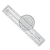
- Enhance Course Accuracy: The rotating aviation plotter from Advanced Pilot Products elevates your navigation experience by allowing precise course plotting and easy wind correction, crucial for student pilots striving for perfection in FAA exam preparation; its rotating design enhances accuracy compared to traditional plotters, simplifying flight planning and reducing errors for seamless cross-country journeys.
- Simplified Navigation for Beginners: This flight plotter is specifically crafted to ease the burden on student pilots by making sectional chart navigation intuitive and straightforward, thus boosting your confidence as you transition from training environments to real-world flight scenarios; its lightweight, durable build ensures learning and planning sessions are both effective and effortless.
- Durability Meets Convenience: Engineered for durability and portability, our rotating flight plotter is your trustworthy companion on both training missions and real-world flights; its robust design withstands repeated use while being lightweight enough to handle easily during cross-country planning, ensuring you never compromise on precision, even in turbulent conditions.
- Essential Training Tool: Tailored for pilot training, this sectional chart plotter elevates your command over navigation by providing a practical, reliable tool that aligns perfectly with VFR navigational requirements; its clear and legible markings make chart reading swift and straightforward, enhancing your ability to focus on mastering flight maneuvers and emergency preparations.
- Streamlined Exam Prep: Transform your FAA exam preparation with this ultimate rotating plotter, designed to make plotting quick, efficient, and stress-free; gain an edge in your aviation studies by relying on a tool that not only supports your learning efforts but also bridges the gap between theoretical understanding and practical application in aviation planning.
- Not permitted: a charge imposed solely for the right of transit, entry or exit.
- Permitted: recovery of costs for air navigation services actually provided to the aircraft, subject to the other Article 15 principles.
How route charges are calculated
ICAO’s manual on charges, Doc 9082, Policies on Charges for Airports and Air Navigation Services, 10th edition (2024), sets out the usual approach. Where practical, a route air navigation services charge should be a single charge per flight for route services at national or regional level. It can be based on the distance flown within a defined area, on aircraft weight, or on both. The guidance treats these as principles that providers adapt, not a formula with fixed rates.
The detail matters when comparing charges:
- Distance: may be measured as a great-circle distance or another commonly agreed measure.
- Weight: may be grouped into broad standardized weight intervals rather than charged by exact weight.
- Airspace and traffic: providers may tailor the method to the characteristics of the airspace and the traffic it carries.
- Flat component: in some circumstances a flat charge may be combined with distance- or weight-based charges.
Because each provider sets its own method, two routes of the same length can carry different charges. Anyone comparing figures should check the charging area, the distance measure, how weight is treated, whether a flat component applies, how the bill is collected and the effective date of the tariff.
Why a provider can charge beyond its own territory
ICAO states that a provider of air navigation services for international use may seek to recover users’ share of costs whether or not the service is used over the provider’s own territory. Where a state has accepted responsibility for route services over another state, over the high seas, or over airspace of undetermined sovereignty, it may levy charges for those services. That authority can be delegated to another state or to an organization.
Collection is the practical complication. ICAO notes that arrangements for services delivered outside the provider’s own state can be complex and are often handled bilaterally or regionally. This is why the same flight can involve a different billing relationship than a domestic one.
Rank #3

- Made of sturdy material to ensure durability even in extreme heat, withstand heat of up to 60 degrees Celsius or 140 F.
- The rotating plotter accurately measures courses and distances on Sectional, Terminal Area and WAC charts.
- 8 functions included on this plotter. Measure in Nautical Miles (Front Side) and Statute Miles (Back Side) along with Sectional Scale (1:500,000) WAC Scale (1:1,000,000) and Terminal Area (1:250,000). Features rotating azimuth for direct course readout.
- With uniform, easy to read fonts and not faded easily to deliver the most efficient, accurate and convenient air navigation plotter on the market.
- The aviation plotter is a great tool to use during flight planning, flight training or study.
A regional example: EUROCONTROL
EUROCONTROL’s Customer Guide to Charges, published 3 April 2026, describes a centralized model. Its Central Route Charges Office bills and collects route charges on behalf of EUROCONTROL Member States. Operators receive one monthly bill in euros, however many Member States they overflew in that month. The guide says the charges fund air navigation facilities and services and support the development of air traffic management.
This is one regional system, not a global standard. Other regions and providers use their own rules, currencies and billing arrangements.
Rank #4
- The chart training guide is published as a service for pilots training with Jeppesen charts. It is intended for reference only and includes some of the most commonly used symbolism. This guide is revised regularly; however some variance may exist between this guide and current chart services. These may be the result of one or more of the following; chart issuance dates, timely application of changes received from governing agencies, and/or the method of representing such information.
Why these charges matter to travelers and budgets
Route charges are levied on aircraft operators, not on passengers as a separate fee. The ICAO and EUROCONTROL material describes charges to operators, and it does not establish how much of that cost, if any, reaches a fare, or how quickly. Any link to ticket prices is therefore a matter for airlines’ own pricing decisions and should not be assumed from the charge alone.
The charges still matter for two reasons. First, they pay for the navigation and air traffic infrastructure that every flight depends on, so they are part of the cost base of operating an airline on a given route. Second, because the method varies by provider, an operator’s costs on one route are not the same as on another. Understanding the mechanism helps a reader interpret airline cost explanations and avoid assuming that a flat “overflight fee” is levied on each passenger.
The Tool Desk
Outbyte PC Repair FREERepair Windows errors before they cause bigger problemsFix Now →Outbyte Driver Updater FREEScan for outdated or missing drivers - takes under a minuteDriver Scan →Best Value
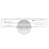
- The flight plotter is made of plastic material to ensure durability even in extreme heat, withstand heat of up to 60 degrees Celsius or 140 F.
- The rotating plotter accurately measures courses and distances on Sectional, Terminal Area and WAC charts.
- More functions included on this aviation plotter. Measure in Nautical Miles (Front Side) and Statute Miles (Back Side) along with Sectional Scale (1:500,000) WAC Scale (1:1,000,000) and Terminal Area (1:250,000). Features rotating azimuth for direct course readout.
- With uniform, easy to read fonts and not faded easily to deliver the most efficient, accurate and convenient air navigation plotter on the market.
- The aviation plotter is a great tool to use during flight planning, flight training or study. Ideal for aviation student training, private pilot training, search and rescue operations, and crew member training. Suitable for flight instructors use as a teaching tool to teach students how to plot routes and measure distances.
How to look up actual charges
- Identify the states or regional airspace the route crosses and the air navigation service provider responsible for each segment.
- Open ICAO’s Aeronautical Charges Online material (formerly Doc 7100) and find the listing for each relevant state.
- Use ICAO’s Aero Tariffs service to estimate airport and air navigation charges and to view the route by FIR (flight information region) segments.
- Confirm the tariff in force on the flight date with the provider or the current official tariff before quoting any figure.
| ICAO resource | What it provides | Limits to note |
|---|---|---|
| Doc 9082, Policies on Charges for Airports and Air Navigation Services (10th edition, 2024) | The principles and methods behind route charges | A policy manual, not a rate table |
| Aeronautical Charges Online (formerly Doc 7100) | Listing of airport and air navigation service charges | Covers 193 States and Territories; the ICAO publications page does not state a year for this figure, and it measures geographic coverage, not fee amounts |
| Aero Tariffs | Estimates of airport and air navigation charges, with an interactive map of routes by FIR segment | Estimates should be checked against the live service and the current tariff |
What the available sources do not establish
ICAO and EUROCONTROL materials do not provide a representative overflight fee amount, an average charge across routes, or a figure for the share of airline costs that route charges represent. Any number quoted in general coverage should be traced to a specific provider, route, aircraft weight and tariff date before it is relied upon.
Quick Recap
Product prices and availability are accurate as of the date/time indicated and are subject to change. Any price and availability information displayed on Amazon at the time of purchase will apply.




